


Voting District 50430, El Dorado County, California
About
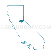
Outline

Summary
| Unique Area Identifier | 529982 |
| Name | Voting District 50430 |
| County | El Dorado County |
| State | California |
| Area (square miles) | 154.52 |
| Land Area (square miles) | 126.22 |
| Water Area (square miles) | 28.30 |
| % of Land Area | 81.68 |
| % of Water Area | 18.32 |
| Latitude of the Internal Point | 38.88757910 |
| Longtitude of the Internal Point | -120.01277910 |
Maps


Graphs
Select a template below for downloading or customizing gragh for Voting District 50430, El Dorado County, California


Neighbors
Neighoring Voting District (by Name) Neighboring Voting District on the Map
- Voting District 20005, Alpine County, CA
- Voting District 20080, El Dorado County, CA
- Voting District 20100, El Dorado County, CA
- Voting District 40285, El Dorado County, CA
- Voting District 40325, El Dorado County, CA
- Voting District 50020, Alpine County, CA
- Voting District 50425, El Dorado County, CA
- Voting District 50445, El Dorado County, CA
- Voting District 50505, Placer County, CA
- Precinct 41 - Daggett, Douglas County, NV
- Voting Districts not defined, Douglas County, NV
Top 10 Neighboring County Subdivision (by Population) Neighboring County Subdivision on the Map
- South El Dorado CCD, El Dorado County, CA (102,407)
- North El Dorado CCD, El Dorado County, CA (31,207)
- South Lake Tahoe CCD, El Dorado County, CA (30,728)
- Lake Tahoe CCD, Placer County, CA (10,448)
- Zephyr Cove CCD, Douglas County, NV (5,402)
- Markleeville CCD, Alpine County, CA (1,175)
Top 10 Neighboring Place (by Population) Neighboring Place on the Map
Top 10 Neighboring Elementary School District (by Population) Neighboring Elementary School District on the Map
Top 10 Neighboring Secondary School District (by Population) Neighboring Secondary School District on the Map
Top 10 Neighboring Unified School District (by Population) Neighboring Unified School District on the Map
- Douglas County School District, NV (46,997)
- Tahoe-Truckee Joint Unified School District, CA (31,699)
- Lake Tahoe Unified School District, CA (29,839)
- Black Oak Mine Unified School District, CA (13,572)
- Alpine County Unified School District, CA (1,175)
Top 10 Neighboring State Legislative District Lower Chamber (by Population) Neighboring State Legislative District Lower Chamber on the Map
Top 10 Neighboring State Legislative District Upper Chamber (by Population) Neighboring State Legislative District Upper Chamber on the Map
Top 10 Neighboring 111th Congressional District (by Population) Neighboring 111th Congressional District on the Map
- Congressional District 2, NV (836,562)
- Congressional District 3, CA (783,317)
- Congressional District 4, CA (774,261)
Top 10 Neighboring Census Tract (by Population) Neighboring Census Tract on the Map
- Census Tract 302, El Dorado County, CA (4,773)
- Census Tract 316, El Dorado County, CA (4,126)
- Census Tract 304.02, El Dorado County, CA (3,723)
- Census Tract 306.03, El Dorado County, CA (3,566)
- Census Tract 304.01, El Dorado County, CA (3,498)
- Census Tract 305.04, El Dorado County, CA (2,912)
- Census Tract 305.05, El Dorado County, CA (2,704)
- Census Tract 305.02, El Dorado County, CA (2,641)
- Census Tract 303.01, El Dorado County, CA (2,469)
- Census Tract 18, Douglas County, NV (2,152)
Top 10 Neighboring 5-Digit ZIP Code Tabulation Area (by Population) Neighboring 5-Digit ZIP Code Tabulation Area on the Map
- 96150, CA (29,792)
- 89449, NV (2,994)
- 96142, CA (1,037)
- 96120, CA (957)
- 95735, CA (68)
- 95721, CA (37)
- 96155, CA (8)